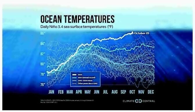
Daily sea surface temperatures in the El Niño 3.4 region of the Pacific Ocean have continued to climb, setting daily records since June and surpassing the all-time high.
CLIMATE CENTRAL
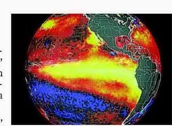
Above and below normal departures in daily average sea surface temperatures are shown in this Earth wind visualization by Cameron Beccario with Nullschool Technologies Inc., based on daily reported satellite observations. Higher departures from normal water temperatures are shown in colors that grow increasingly lighter yellow, while cooler-than-normal temperatures are shown in increasingly lighter blue shades.
The warnings about El Niño continue to roll in. The United Nations' weather agency weighed in on Wednesday, calling the potent climate pattern a "behemoth" and a "wrecking ball."
Traveling through Kannapolis this week? NCDOT has scheduled two overnight closures on U.S. 29, with southbound and northbound traffic affected…
Daily sea surface temperatures in the El Niño 3.4 region of the Pacific Ocean have continued to climb, setting daily records since June and surpassing the all-time high.
Above and below normal departures in daily average sea surface temperatures are shown in this Earth wind visualization by Cameron Beccario with Nullschool Technologies Inc., based on daily reported satellite observations. Higher departures from normal water temperatures are shown in colors that grow increasingly lighter yellow, while cooler-than-normal temperatures are shown in increasingly lighter blue shades.